Saturday, March 31, 2018

Project Blog 3/31


This week, we completed our plate tectonics project. My group chose to do Discovery, where we needed to find out how far each of the plates would move in a year. The image above is a drawing of this. The areas that are outlined in red are the plate boundaries and the land is the green and brown, and the rest are the plates. I had a great time completing this project, and I learned a lot about Math and Science while I was at it. To find out how far to move the plates on the map, we took the diameter of the Earth (in cm), multiplied it by how far it was to move in a year, divided by 24, and moved them. There was a lot of Math and teamwork involved with this project.

Backward-Looking: What resources did you use on this piece? Were any especially helpful? Are there any that you will use again?

To do this, we found a very helpful website on the directions each plate is moving and how far per year. I will use this again. Athena was helping us by reading them out to us and me and Mackenzie put them in the table. For most of the Math, I simply typed the numbers and symbols into the Google Search bar and the correct answer came up. I will definitely use the Google Search bar again.

Inward-Looking: What was particularly satisfying to you about either the process or the product?


To me, seeing the map that we made was the most satisfying. We had created a pixlr.com drawing of the new Earth and I copied it down onto a drawing as our map. The table that we made was also satisfying. There were four columns: the name of the plate, how far it moved per year, how far it would move in 150 million years, and the direction that the plate was going in.

Outward-Looking: What is one thing you want people to notice when they look at this piece?

I want people to see that we really did our best when they look at our work. We tried so hard and tried to be as accurate as possible and I’m not totally sure if we got it right, but we really tried our best on this piece of work and I want people to notice this.

Forward-Looking: What would you change if you had a chance to do this piece over again?

I would try to make it more accurate, for one thing. I would also try and make the map look neater and more realistic, like the pixlr drawing that we did.

Tuesday, March 27, 2018

Plate Tectonics Project 3/26/18


https://opentextbc.ca/physicalgeologyearle/wp-content/uploads/sites/145/2016/06/volcanic-tectonics.png

This week, we began our plate tectonics project. We were free to choose whatever topic we wished within the 5 topics our teacher gave us. Me and my group chose to do the Discovery project, where we have to do some research and a lot of math to find out where the tectonic plates of the Earth will be in 150 million years. We thought it would be easy, just a few simple calculations, but it wasn't. We had to do a lot more work on it. We started with finding out how many tectonic plates there are (17), and their names*. We also figured out how far each of the different plates move per year. We thought it was around 2, but all of them have a different number, so we found the exact. We then multiplied each of those numbers by 150 million to find out how far they would move in that much time. We then discovered the direction each of them move in*. After that, we found out the diameter of the Earth in centimeters, and then we divided by 24 and multiplied that by the number of cm each plate was to move in 150 million years to find out how many little squares to move it. We are using a coordinate grid of latitude/longitude to move them, and so we move them the number of squares to get our answer. Then we made a pixlr drawing of the new Earth. We're still in progress, but we're doing really well.


Pacific Plate

Moves 9 (7-11) cm per year

1,350,000,000 cm/25.4277194 cm

North west


North American Plate

Moves 2.3 cm per year

345,000,000 cm/6.49819495

Southwest


Juan De Fuca Plate (won-dee-fooca)

Moves 4 cm per year

600,000,000 cm/11.3012086

Northeast


African Plate

Moves 2.15 cm per year

322,500,000 cm/6.07439962

Northeast


Antarctic Plate

Moves 1 cm per year

150,000,000 cm/2.82530215

Northwest


Australian Plate

Moves 3.7 cm per year

555,000,000 cm/10.453618

North


Indian Plate

Moves 3.1 (2.6-3.6) cm per year

465,000,000 cm/8.75843667

Northeast


Eurasian Plate

Moves 3 cm per year

450,000,000 cm/8.47590645

south east


Nazca Plate (naz-cuh)

Moves 3.7 cm per year

555,000,000 cm/10.453618

East


Caribbean Plate

Moves 1 cm per year

150,000,000 cm/2.82530215

Northwest


Cocos Plate (coh-cohs)

Moves 6.7 cm per year

1,005,000,000 cm/18.9295244

Northeast


Scotia Plate (scoh-shia)

Moves 2.5 cm per year

375,000,000 cm/7.06325538

West


Filipino Plate

Moves 6.6 cm per year

990,000,000 cm/18.6469942

Northwest


Arabian Plate

Moves 1.75 (1.5-2) cm per year

262,500,000 cm/4.94427876

North


South American Plate

Moves 7.7 cm per year

1,155,000,000 cm/21.7548266

West

S&EP: SP2, Using Models
We are using a lot of models to discover more about this topic. We are using a pixlr drawing of the Earth (an online model) to separate and move the plates the appropriate amount of space that they should move per year. Once we have that done and we know the new position of the plates, we are going to make a paper mache model of the Earth to show the new whereabouts of the plates. 

XCC: Patterns
We are using a lot of patterns in order to make our drawings and models work. We used a lot of math, which is a pattern, but we're also using the patterns to move the plates around and to make the new model. We had to take the Earth's diameter in cm, divide by 24, and then multiply by the number of cm it was to move in 150 million years. Then we used the latitude and longitude squares on the Earth model to easily move the plates to where they will be at that time.

Monday, March 12, 2018

Regrade on Plate Tectonics Quizziz Game 3/11/18


The theory that states that the Earth's continents once made up one big continent is the theory on Pangea. That was the name of the big super continent. But the theory that they drift apart is the theory of plate tectonics, which is the correct answer.


Divergent plates pull apart from each other. Transform boundaries slide past each other. Faults in the ground are caused by transform plates sliding past each other.


Transform boundaries that slide past each other shake the ground. They are the cause of earthquakes. The state of California is located on a transform boundary.


Subduction is when the oceanic crust is pushed under the continental crust and turned back into magma in the mantle. Divergent is the correct answer because the old crust is recycled away into magma during subduction and is pushed up into the lithosphere in a divergent boundary. The magma hardens and cools into crust.


Continental drift is the theory that the continents sometimes move around a little bit over a long period of time and become in different locations. They 'float' on the mantle, which is moving the continents around because of convection currents. The air near the inner core gets hot, so it rises. The closer it gets to the lithosphere, the more it cools, so it sinks. The convection currents pushing the continents around are the little currents that the air makes and it heats, rises, cools, and sinks.

Sunday, March 11, 2018

Plate Tectonics 3/11/18


This week we were talking about plate tectonics. We learned that the newer crust could be found closer to ridges under the ocean and the further the crust was from the ridges, the older it was. Old crust is recycled at subduction zones where it goes underneath the other crust into the mantle and becomes a liquid again. To depict this, we did a great lab on Friday called Snack Tectonics to help us learn the processes of plate tectonics.

First we had a spoonful of frosting that the teacher gave to us. We had to spread it around until it was a rough rectangle.

After we did that, we unwrapped two fruit roll ups and lay them side by side on the frosting. We then gently pulled them apart to show divergent boundaries.


Next, we removed one of the fruit roll ups and ate it. We placed a graham cracker next to the fruit roll up and pushed it together. This shows a subduction zone, because the graham cracker went above the fruit roll up.


Then we ate the next fruit roll up, and took another graham cracker. We dipped the ends in water and then placed them back on the frosting. Then we pushed them together. This shows continent-continent collision. It made a mountain!


I learned a lot about how these plate tectonics move and collide to form different things in these labs that we have done.

S&EP: SP2, Using Models.
I used a lot of models in these labs. We used the wet graham crackers to show mountains, the fruit roll ups to show subduction zones and the divergent plates. This really helped me to learn more about how all of these boundaries worked.

XCC: Cause and Effect
If the tectonic plates move and collide, then mountains will form. If they split apart, divergent boundaries will form. And if an oceanic crust and continental crust meet, then one will submerge in magma and be recycled. These are all examples of cause and effect relationships.

Sunday, March 4, 2018

The Rock Cycle


This week we began to learn about the rock cycle and the layers of the earth. We did a really cool lab to help us understand about how rocks are formed and we watched some videos and did some interactives on the layers of the earth and what causes earthquakes.

The Rock Cycle

There are three main types of rock, sedimentary, igneous, and metamorphic. Each rock has a different way to turn into that type and how to turn into another type of rock.

Sedimentary Rocks

Sedimentary rocks are made out of sediment. Sediment is little pieces of pebbles, rocks, fossils and sand that gradually accumulate and cement themselves into rocks. They take time, and sedimentary rocks are the only rocks that have fossils in them. They are quite crumbly and break easily.


Igneous Rocks

Igneous rocks are sometimes known as volcanic rocks. They are formed when magma within the earth or lava outside of the earth cools and hardens into rocks. This process happens so fast that no crystals can grow on the surface. Igneous rocks are smooth and glass-like with gas bubbles in them.


Metamorphic Rocks

Metamorphic rocks are formed underneath the earth when intense heat and pressure compacts layers of dust and rock into metamorphic rocks. This takes a really long time, so you can find crystals growing on them.


Metamorphic rocks can melt and harden to form igneous rocks, which can crumble up and become part of sediment, which can become compressed and form metamorphic rocks.

In our lab, we used candy to depict this. We were in partnerships, and each partnership had two Starburst candies. We were supposed to cut the Starbursts into little pieces (the smaller the better) for sediment. Then we would gently press the ‘sediment’ into a ball for a sedimentary rock. We recorded our findings.

We added lots of pressure with our hands to compress the Starburst sedimentary rock into a metamorphic rock. Once again, we recorded our findings.

Lastly, we placed our metamorphic rock in a paper cupcake cup and placed it into the microwave for 35 seconds. When we took it out, it was a liquid, but when it hardened, it had gas bubbles and a smooth surface. We had turned it into and igneous rock! The photo above at the very top is my igneous rock that I made with my partner. It was a cherry and lemon mixture, which tasted great as well.

We were also learning about the layers of the earth this week. There were the compositional layers, which included the crust, mantle, inner core, and outer core. Then there are the physical layers, which are the lithosphere, asthenosphere, the mesosphere, the outer core, and the inner core.

Compositional Layers

Crust

The crust is the thinnest layer of the earth; it is only 5-100 km thick. It includes the ocean floor and dry land, which is called the oceanic and continental crusts. It is made up mostly of silicon and oxygen in the form of granite and basaltic rocks.

Mantle

The mantle is the thickest layer of the earth, measuring 2,900 km thick. It is a semi-solid layer made up of silicate, iron, nickel, and magnesium. Magma that spews out of volcanoes comes from the mantle.

Outer Core

The outer core is a layer of liquid metal, mostly iron and nickel. It is 2,200 km thick.

Inner Core

The inner core is made mostly of iron and nickel as well. The pressure in it is so great that it becomes a solid ball. Its diameter is 2,456 km. When the outer core spins around it, the earth’s magnetism is created.

Physical Layers

Lithosphere

The lithosphere is about 15-300 km thick. It is cold and brittle, very easily broken. It is a combination of the crust and the upper region of the mantle.

Asthenosphere

The asthenosphere is the weak sphere. It is 250 km thick. It is a soft layer of hot semi-liquid that is constantly moving in convection currents (which will be explained later on). The plates of the lithosphere ‘float’ on the asthenosphere.

Mesosphere

The mesosphere is the middle sphere. It is the rest of the mantle that the lithosphere and the asthenosphere don’t take up, which is about 2,550 km. It is much stronger and hotter than the asthenosphere. It is a semi-solid, and it is believed that the pressure keeps it from flowing like a liquid.

Outer Core

The outer core is the only actual liquid layer of the earth. Although it is pretty much a superhot sea of iron and nickel, magma and lava DOES NOT come from here.

Inner Core

The inner core is the solid, dense core of the planet, a solid ball. The outer core’s rotation around it is what causes the earth’s magnetism. The earth’s inner core is hotter than the surface of the sun. The sun’s surface is about 5,500 °C. The inner core is about 6,000 °C. But the sun’s core is 15,000,000 °C, so the earth’s core is a lot colder compared to that.


https://rozsascience.files.wordpress.com/2013/01/the_earths_layers_foldable_completed.jpg

This is the foldable that we did in class to visualize this.

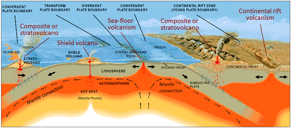
The convection currents are what cause earthquakes. The air gets hot from the inner core, and so it rises. Then is get cold from up there, so it sinks. This repeats around in there, sometimes causing the tectonic plates to shift.

S&EP:SP2, Using Models.

This week I learned a lot about the rock cycle and the earth’s layers because we made that foldable and did that lab. If those Starburst candies were actually rocks, it might have helped a tiny bit more, but that lab really helped to make sense of the rock cycle. And with the foldable we made, it showed all of the layers and what was going on.

XCC: Structure and Function.

If one of the earth’s layers wasn’t strong enough to support the other layers, the earth would completely fall apart. It is really important that everything is strong enough to support everything else and functions right to make everything okay.

Is There Life in Space? 5/23/19

Link  by NASA Solar System Exploration       We all know the typical sci-fi movie where an alien monster drops out of some unknown pl...